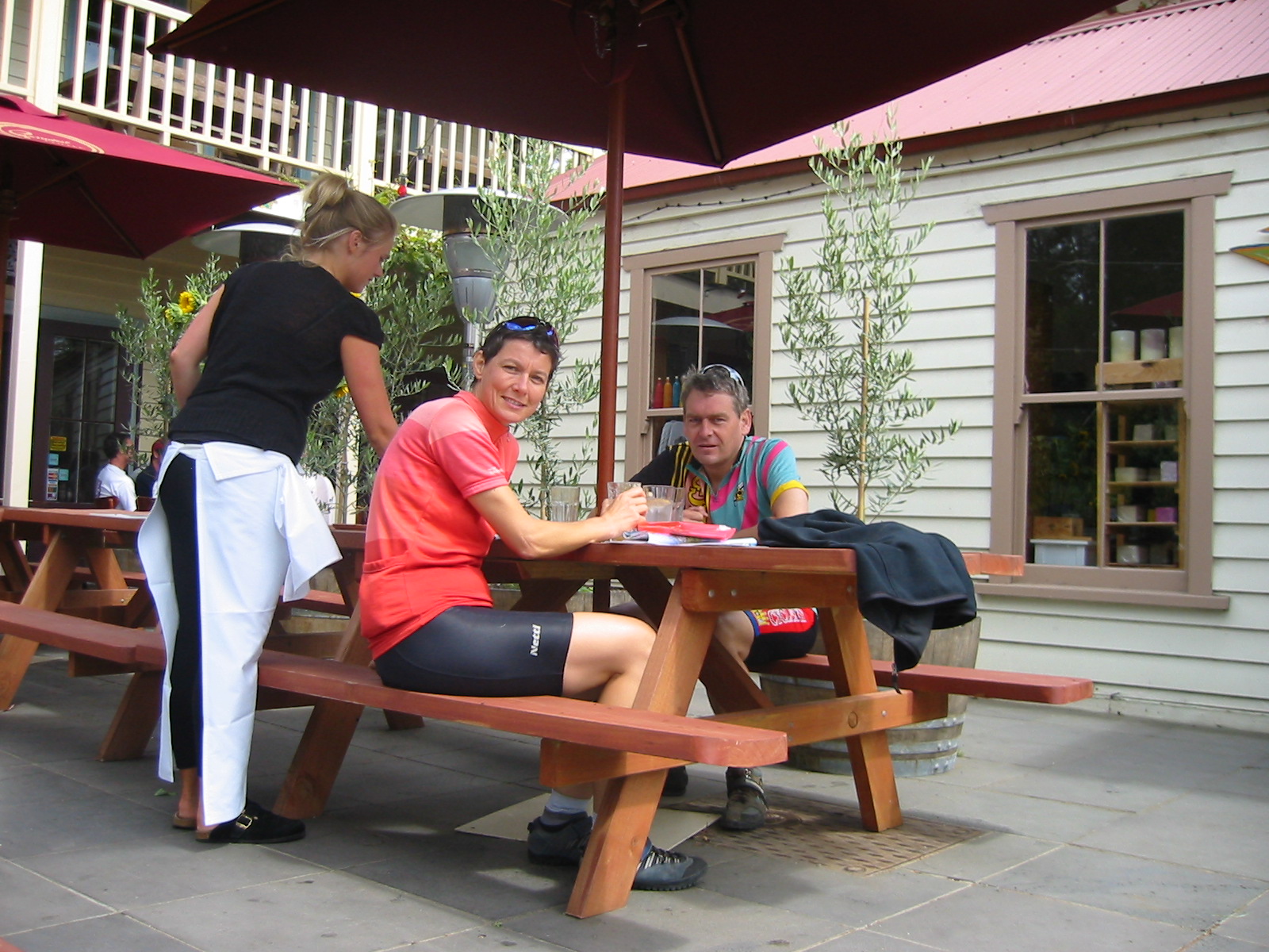
 We reach Lorne at 11:00 (after 46km), where we have a nice breakfast
(three servings between the two of us, the waitress looked slightly puzzled).
We reach Lorne at 11:00 (after 46km), where we have a nice breakfast
(three servings between the two of us, the waitress looked slightly puzzled).We leave home at about 14:00 to ride to Sydney Airport (6km). We pack the bicycles into mandatory boxes (at $15 each) and fly to Avalon airport, about 20km north of Geelong, where we start cycling at about 16:45. The ride from there is almost exactly due south, which means straight into a moderately strong southerly, to which we are fully exposed in the flat countryside.
We reach Torquay at 19:15, and decide to stay (the alternative would be to ride on to Anglesea, but that goes across some hills so we aren't certain how long it would take). We camp at a huge council caravan park right at the sea, which has only powered sites ($40 each, most expensive camp site of the trip). We set up tent before sunset (around 20:45). Fortunately there's a fish-and-chips shop still open (not guaranteed on Christmas day) and we hit the sleeping bags around 21:30. Unfortunately, sleeping isn't easy, due to group of obnoxious Poms who keep being very noisy until after midnight.
We leave Torquay at 8:40, on a sunny and quiet morning with hardly any air movement. There's a gentle climb, then downhill to Anglesea, which we pass without stopping. Two more hills, including one called Big Hill (with all of its 99m), but they aren't bad.
We reach Lorne at 11:00 (after 46km), where we have a nice breakfast
(three servings between the two of us, the waitress looked slightly puzzled).
 We move on at noon. The wind has picked up in the meantime, blowing with moderate
strength from the SSW, which means mostly into our
faces. Riding is easier than on the previous day, as we are less exposed
to the wind, and the landscape is much more varied.
We move on at noon. The wind has picked up in the meantime, blowing with moderate
strength from the SSW, which means mostly into our
faces. Riding is easier than on the previous day, as we are less exposed
to the wind, and the landscape is much more varied.
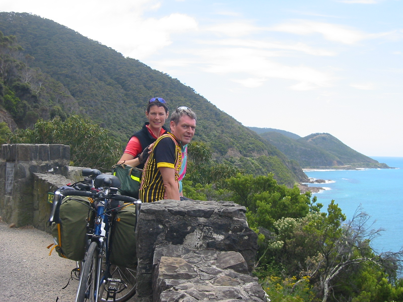
Just before Mt. Defiant Lookout we have a very scary moment, as Trudy (riding ahead) gets hit by an idiot with a camper trailer overtaking her and pushing her against the railings. Fortunately, she doesn't come off and sustains no damage, except for a little scratch and some wear on her panniers. But it is a stark reminder of the presence of way too many incompetent and irresponsible drivers.
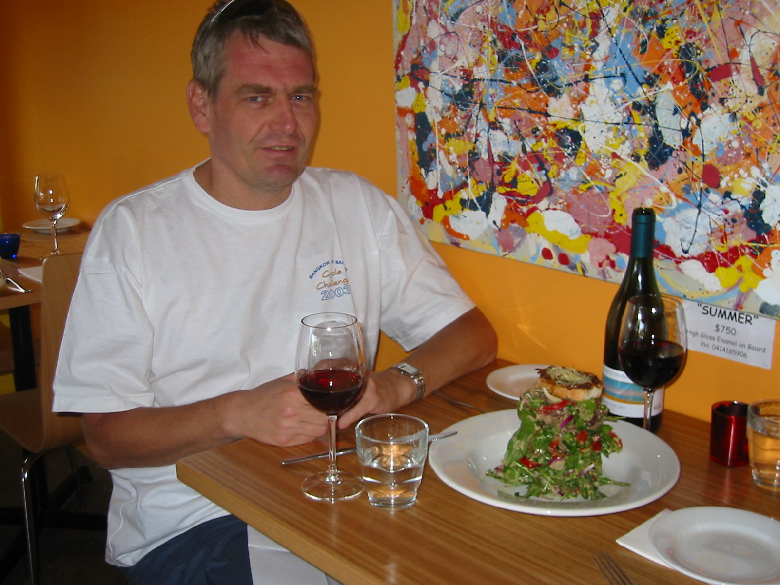
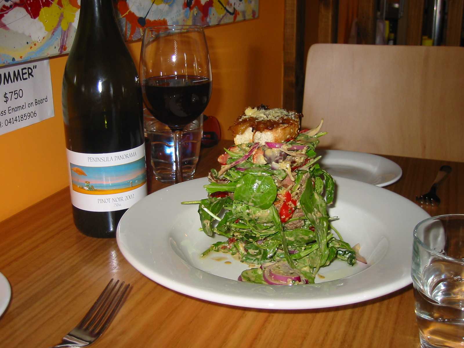 With the headwind we take frequent stops and arrive at Apollo Bay
just before 15:00. Later, as we sit on a pub's terrace having a drink
until the restaurants start serving dinner, we see two bicycle tourists going
the other way. We have dinner in a nice restaurant, which, true to the
conventions of Modern Australian cuisine, likes to stack its food.
With the headwind we take frequent stops and arrive at Apollo Bay
just before 15:00. Later, as we sit on a pub's terrace having a drink
until the restaurants start serving dinner, we see two bicycle tourists going
the other way. We have dinner in a nice restaurant, which, true to the
conventions of Modern Australian cuisine, likes to stack its food.
Throughout the night we had a number of rain showers, one just before we get up, and another as we are just getting ready to leave. They will stay with us throughout the day.
We depart Apollo Bay at 8:25, battling a strong westerly as we climb into the hills of Otway National Park. We meet several rain and hail showers, but manage to find coverage each time, so we never really get wet. Still, it is a tough ride, uphill with cold headwind, which turns into a southerly by mid-morning.
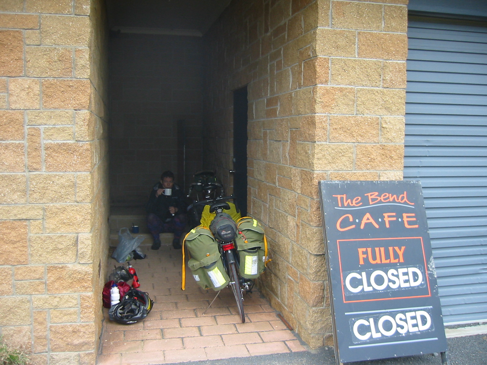 After coming down from the first hill and battle the headwind in an
exposed valley at Castle Cove, we see a café at the bend of the
road, and we are looking forward to a hot soup. Unfortunately, the café
is closed (and for lease), and we have to cook our soup ourselves in the
shelter of their alcove. To this point it took us two hours for all of 30km.
After coming down from the first hill and battle the headwind in an
exposed valley at Castle Cove, we see a café at the bend of the
road, and we are looking forward to a hot soup. Unfortunately, the café
is closed (and for lease), and we have to cook our soup ourselves in the
shelter of their alcove. To this point it took us two hours for all of 30km.
Things go a bit easier from here, even though this is the climb up to Lavers Hill. The wind is from behind at first, hitting us side-on a bit later, but we soon are protected by hills and forest and feel almost no wind. We reach Lavers Hill (about 500m a.s.), fairly worn out, around 13:00.
We have a big lunch at a bistro at the top (we felt like steak but had to do with burgers). We leave again at around 14:10, and soon after the beginning of the descent come across a sole cycle tourist making his way up.
The wind is strong again, so that we are riding in the low 20's even on slight downhill bits. There are also plenty of short reverse climbs. Due to the strong headwinds it takes us 50mins for the 19km to the Gellibrand River, in spite of a net 450m drop.
From Gellibrand River we take the Old Ocean Road, which is unsealed and generally in excellent condition, almost no corrugations and definitely suitable for road bikes. It's about 1km shorter than the main road, but, much more importantly, cuts out the hills (which, from the map, look like a 200m climb), and absolutely all traffic. Definitely worthwhile taking under the circumstances.
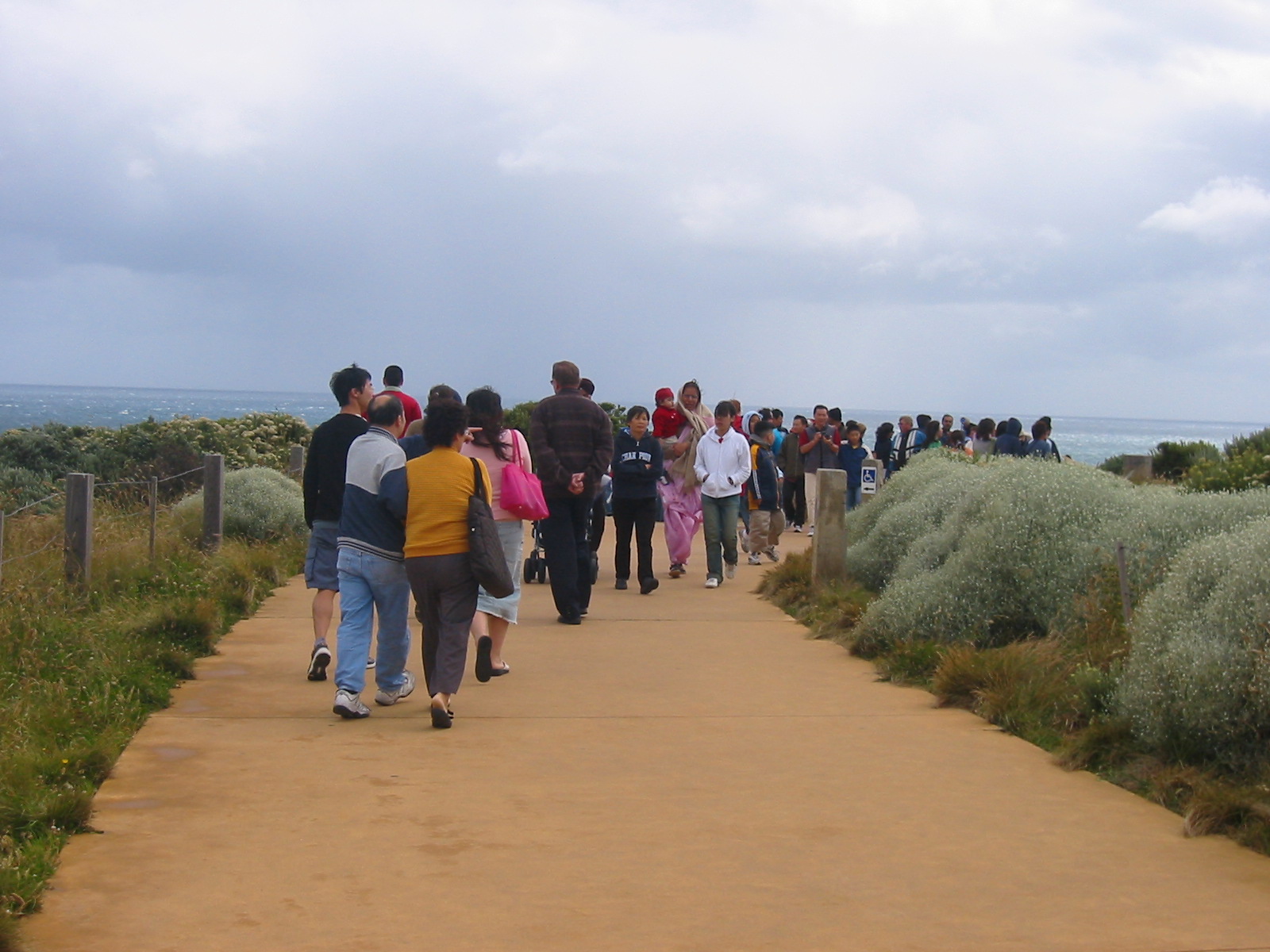
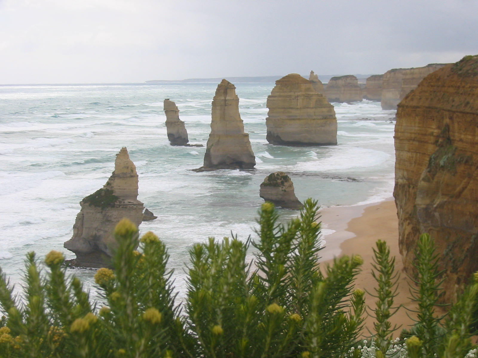 Soon after we hit the coast again, with all its famous pinnacles. We
take a quick stop at the Twelve Apostles, which are incredibly busy, in
spite of the poor weather. This is where we take our last pictures;
after that the battery goes flat. And the replacement battery pack is
flat too—we obviously weren't very organised with our preparations.
Soon after we hit the coast again, with all its famous pinnacles. We
take a quick stop at the Twelve Apostles, which are incredibly busy, in
spite of the poor weather. This is where we take our last pictures;
after that the battery goes flat. And the replacement battery pack is
flat too—we obviously weren't very organised with our preparations.
After some more battling of winds, which at different places come from the front, rear or side, at times quite dangerously, we reach Port Campbell at 17:30. It was the coldest (17°C maximum), very windy (mostly from ahead) and wettest day; we were wearing long pants all day and our fleece jackets most of the time. It probably was the toughest day of the whole ride.
For a change we had breakie in a takeaway café (although it was only marginally filling) and leave at 8:10. The weather is essentially the same as the previous day: cold (long pants all day), grey, windy, although not as wet (we only went for shelter once). The wind is from the south again, which means it's mostly a tailwind now. It makes a big difference, we go 35km/h with the wind from behind, 12km/h against it. Frequently it is from the side, which still makes going hard.
We do some quick sightseeing (London Bridge, The Grotto and the Bay of Islands), then the Great Ocean Road turns away from the coast. Traffic is very light that early in the morning. We ride small country roads (including a 5km stretch of dirt road), staying south of the main road and its traffic (except for a 2km stretch) until Warrnambool, which we reach at noon (after 66km).
Gernot has some problems with his left knee, probably a consequence of the tough day before, so he's trying not to push too hard. At Warrnambool we have a long break with a nice and pretty substantial lunch at a place called Fishtales. We buy a newspaper and for the first time read the horrible news about the Tsunami that devastated southern Asia. This will be pretty much all the front-page news for the rest of the trip.
From Warrnambool we are on the A1, part of the National Highway that encircles the continent. It has a fair amount of traffic, including road trains. For the last 8km into Port Fairy we can take a small road close to the coast again. We pitch our tent at the caravan park (on a nice grassy and somewhat protected spot). Given the unattractive weather, we only go for a quick dinner (the restaurants are starting to get less inspiring the further we get away from Melbourne) and then an early sack.
We make a 8:35 start on another grey, windy and cool day. However, it lightens up in the course of the morning, so much that Trudy (known to suffer frostbite from seeing a whisky on the rocks) takes her longjohns off after an hour.
The morning is mostly easy riding, with the southerly in average coming slightly from behind. We make it into Portland at 12:15 (after 73km). We decide that we shouldn't have a problem making Nelson (just before the South Australian border) and book a campsite through the local tourist information.
The weather turns really nice in the afternoon, with clouds all but gone by 4pm. The wind keeps changing between the well-known southerly and a much weaker easterly, both in our favour. It's an easy ride on an excellent road through slightly undulating countryside. In fact, with the tailwinds we hardly notice that we are making a fair bit of altitude until there's a nice downhill run (which gets us going at up to 64km/h).
We get into Nelson at 17:00, where, for a change, we enjoy the beautify late-afternoon sunshine with some nice ice cream at the General Store. Despite the distance it wasn't a particularly hard day. Nelson is a small town with a lovely harbour (the mouth of the beautiful Glenelg River, on which you can do boat tours), a pub with decent food, a servo (which also serves food) and two caravan parks.
We leave at 8:15 with a light to moderate easterly (which means tailwind). There is a little bit of high cloud, which intensifies during the day. The road goes through slightly undulating countryside towards Mt. Gambier, but after 20km we turn left at Caveton onto a road which in our map is marked as unsealed, but is in fact excellent bitumen, and signposted as a ``heavy vehicle bypass''. There is, in fact hardly any traffic on this route, which is about the same distance as going through Mt. Gambier, but very flat (while the area around Mt. Gambier is quite hilly).
It is very pleasant riding through flat grazing country (some of it irrigated). By mid-morning the wind changes to a (fortunately weak and intermittent) northerly. We have a quick food and drink stop at Kongorong, and another drink stop at Tantanoola, before we hit the Princes Highway (A1) a few km out of Millicent, where we stop for lunch at 13:15 (13:45 Victoria time).
This is the place where the quality and variety of food, having been on a downhill slope since Melbourne, reaches rock bottom. It is also noticeable that no-one seems to take any interest in (or even notice of) a couple of cycling tourists, which cannot be a frequent sight around here.
We continue at 14:15, along the coast (away from the A1). The wind has by now almost completely died down, and it is getting hot. Later a moderate SSW picks up, which is neutral for our direction (although significant side wind still slows you down) but has the advantage that it comes from the sea and is therefore cool. It turns south later, and therefore into more of a tail wind. The road is flat and mostly very straight, and the ride is uneventful.
We arrive at Beachport at 16:00, get literally the last spot at a crowded caravan park right at the sea. We even take a quick dip in the sea—the water is cool but not as cold as expected. Getting some sleep turns out to be a bit of a challenge, as there is (unsurprisingly) a noisy group of drunks (this time Aussies) nearby. We are determined not to spend New Year's Eve at a caravan park!
We manage a really early 7:10 start. It's very quiet, almost no traffic, almost no wind. At one stage, a kangaroo and her joey are racing us for a while at around 30km/h :-)
A peaceful 50km ride gets us to the small town of Robe at 9:40, where we have a nice second breakfast at a café. By the time we leave at 10:40, a moderate northerly has developed. This is double jeopardy, as it not only means that we are riding straight into the wind, it also means it's hot and dry. The 44km to Kingston SE are very tough and we arrive just after 1pm exhausted and somewhat overheated (according to next day's paper the temperature was 37°C—good thing we didn't start later).
After having a big lunch (with lots of cold drinks) we try to gather information on what's ahead. The map shows 146km to Meningie with nothing in the first half, and no sure indication of services in the second. We ask at the post office (and are later able to confirm the information when we meet the local cop) that there is indeed nothing, not even drinking water, for almost 90km.
We decide that we can carry enough water to get us over this stretch overnight. We stock up (packing a total of 13l liquid), but take a long rest before continuing. In the afternoon the wind turns SSW and some clouds develop, and consequently the temperature drops a fair bit. So we hit the road again at 16:30.
From here on we are back on the Princes Highway, but since this is New Year's Eve and getting towards evening, the traffic is very light. We get passed by only a single road train (who gives us a wide berth). Together with the tailwind and pleasant temperature this makes it a fun ride, and we cruise along with 30+km/h for 2.5h. The road is almost perfectly flat; on the left are dunes and shallow lakes, and to the right grazing country.
At 19:00 sharp we pull into a small (and very rough) access road into Coorong National Park and camp maybe 100m away from the highway, protected by a dune. The traffic soon dies down completely and we have a very quiet and romantic night (greeting the New Year sleeping peacefully). We hear nothing but wind, the sea, the occasional bird, and very rarely a car.
After a very quiet night we get up to a quiet, overcast day, no cars (the first one we hear just before getting up, the next one is as we are just about to hit the road, the third is an hour later). We hit the road at 6:35 with a wind that is still blowing from the south, making it an almost perfect tail wind and we fly with a sustained average of over 27km/h (including breaks).
We reach the Salt Creek roadhouse at 7:30, and, amazingly, it's open. We still have about half of our liquid, and breakfast wasn't too long ago, so we continue after only a short breathing rest, and soon after meet a Swiss cyclist who is riding from Adelaide to Melbourne. We stop at Policemans Point roadhouse for a second breakfast (having done 35km so far).
The day continues to be grey and cool, and the wind (still a southerly) picks up. The route is mostly flat, with a few small climbs over dunes. It runs between the Coorong, a narrow body of water separated from the ocean by the 120km-long Younghusband Peninsula and mostly featureless grazing country.
At 11:00, after 87km, we reach Meningie, a somewhat bigger but rather uninspiring town. After a lunch of fish & chips and a bit of a rest we continue at 12:10 north on the A1. For an hour after lunch there is significant traffic, and we are a bit worried as some of the motorists drive quite irresponsibly and we suspect that a fair number of them still has significant blood alcohol levewls. Fortunately, the traffic settles down again after an hour.
We pass through rolling grazing country again, easy riding with the continuing tail wind. After an uneventful ride we reach Tailem Bend on the Murray River at 14:30, and decide to pull into the caravan park, which is about 7km N of town right on the Murray. We skip Old Tailem Town.
We wake up to a beautiful clear and cool morning with blue skies and only the slightest SE breeze. We head off at 7:00 and where the freeway starts just outside Murray Bridge, we follow the blue signs showing the cycling route to Adelaide. Full points to Transport SA for putting them there (we only wish they'd continued it later).
In Murray Bridge the smell of fresh bread draws us across the block into a bakery where we indulge in some fresh goodies. From there we ride a quiet road though beautiful, hilly countryside. It leads us to Monarto South, Callington, the beautiful village of Kanmantoo, Nairne and finally to Hahndorf, where we arrive at 11:20 after 73km, in time for lunch before the restaurants get busy.
Hahndorf (as the name indicates) is a German settlement (from the 1840s) and is now essentially a tourist trap (complete with pseudo-German food). We take a bit of a rest out of the sun before braving the last of the hills.
At 13:30 we leave Hahndorf behind; by now it is quite warm. The road keeps going uphill with a good grade, reaching about 600m above sea level. At Stirling, about 200m past the castle of Foreign Minister Alexander Downer (recognisable by the TV crews hanging around) we're stumped, as the road turns into a freeway on-ramp, with no obvious alternative way for cyclists to continue west. Would be nice of Transport SA had done a more complete job with its signposting for cyclists!
The Police station is closed until the late afternoon, and we try asking some passers-by. They know of some path that supposedly exists, but can't tell us where. Finally we spot an (obviously local) cyclist, who is indeed able to point us the right way: a rough and steep footpath which starts at the roundabout just before the freeway entrance, goes along the freeway for a bit and leads to a footbridge across the freeway to Crafers. There we need to ask again, but, as the petrol station attendant says, “it's easy! There's a roundabout, and at its far end there are, once again, signs leading to a cycle track. (Read more details in the section on Murray Bridge to Adelaide “From Stirling...” on our Roads and Maps page.)
From here on it's pure fun, all downhill! First on an old road (in excellent condition), narrowed to three lanes of about a metre width, one each way for cyclists and the third for pedestrians. This leads to Eagle's Nest Lookout, from where we have a beautiful view over Adelaide. We are now on the old road that was replaced by the freeway, four lanes of winding roads that is essentially only used by cyclists, plus the odd motor bikers who drive up to the lookout for fun (and presumably in the evening some car traffic to the restaurant at the lookout). The road is a dead end for everything but bicycles!
We enjoy the fast downhill ride into the outskirts of Adelaide, where it turns into Glen Osmond Road, one of the main thoroughfares. Traffic in the city on a Sunday afternoon is very light, and we have a pleasant conclusion of our ride, when we reach our hotel (which we had booked via the Internet from Hahndorf) at 15:45.
As we are a day earlier than budgeted, we rent a car on Monday and drive out to the Barossa Valley. This is our first trip to Australia's most famous wine area, and we spend about half a day exploring,including some wine tasting,and then driving back to Adelaide via Eden Valley and the Torrens River Gorge.
We consider ourselves lucky not to be cycling that day. It started off with a fairly strong north-easterly and by mid-day has become quite hot. The afternoon features spectacular thunderstorms with very strong winds and very heavy downpours, complete with roads blocked due to fallen trees. Definitely not a great day for cycling!
Tuesday is all grey, at times strong westerly and a fair bit of rain in the morning. By the time leave we for the airport at 16:00 it is dry with the occasional bit of sun, but still quite a westerly (i.e. headwind). Fortunately it is only about 5km to the airport.
When we arrive in Sydney the weather isn't any better; in fact it is raining heavily as we are taxiing to the gate. Hence we decide to leave the bikes in the boxes (which we had to buy again in Adelaide) and load them into a taxi—we don't feel we have any more to prove ;-)
Return to main page of Melbourne-Adelaide main page