 Photo journal of our 1-day explorer in Nitmiluk NP
Thursday, 18 March 2021
Photo journal of our 1-day explorer in Nitmiluk NPTo enable an early start we drive down from Darwin to Katherine the night before and stay at a motel.
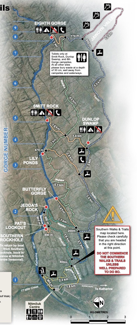
The plan for the day is to survey the southern gorge system (up to Number 9, see map to the right) from the air, get dropped off near Number 8 Gorge and then walk back to the Nitmiluk visitor centre. The walk itself is meant to be exploratory in the sense that we are going to explore, amongst others, a new track, which may, or may not be signposted at this time—we may have to simply find our own way back should we end up to far off the existing trails.
Additionally, we are not expecting any other hikers, as the park is still closed to general tourists for the Wet Season. Our trusted guide, Russell, is well known and connected with the local authorities and has organised a special exploration permit.
The weather is overcast and humid, but there is no rain looming. The countryside is fairly flat, and we can see far into the distance.
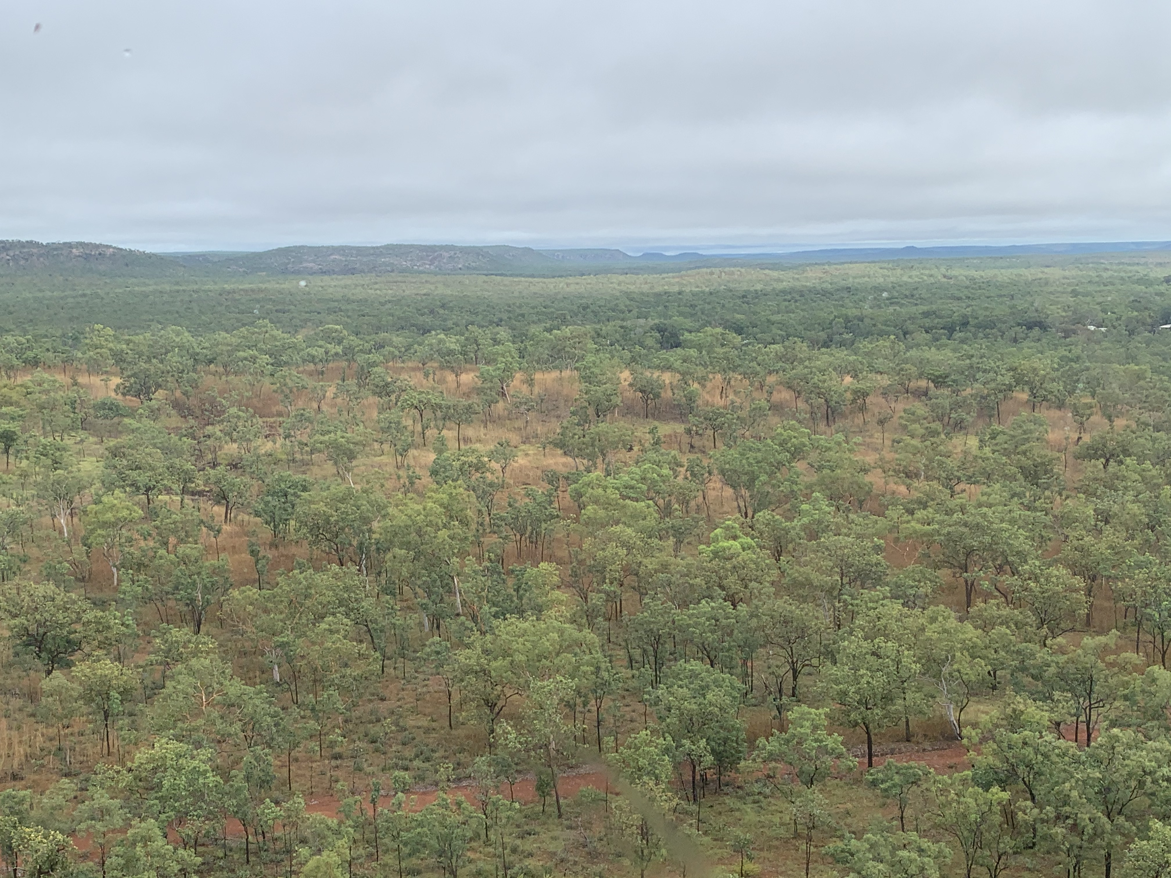
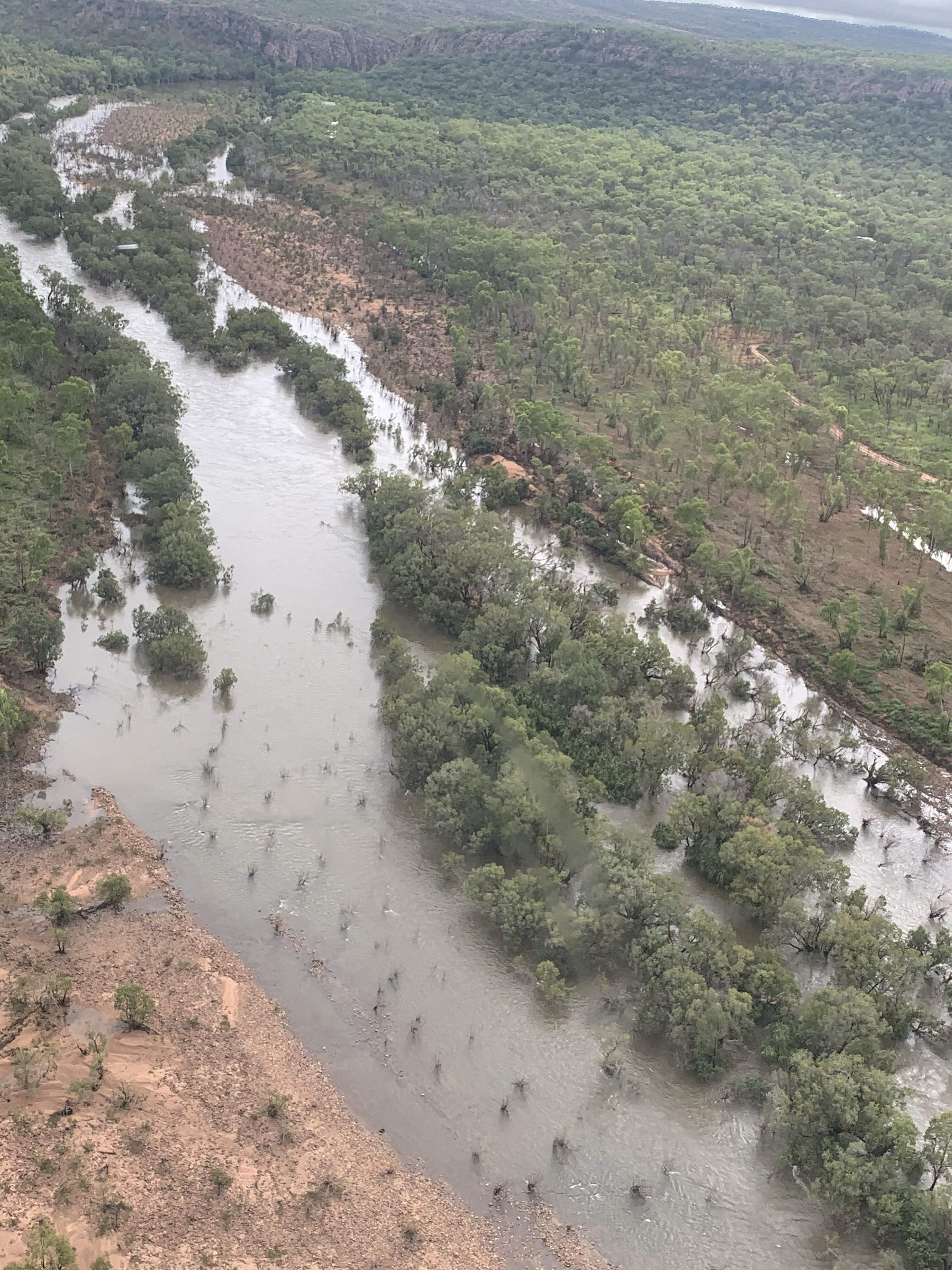
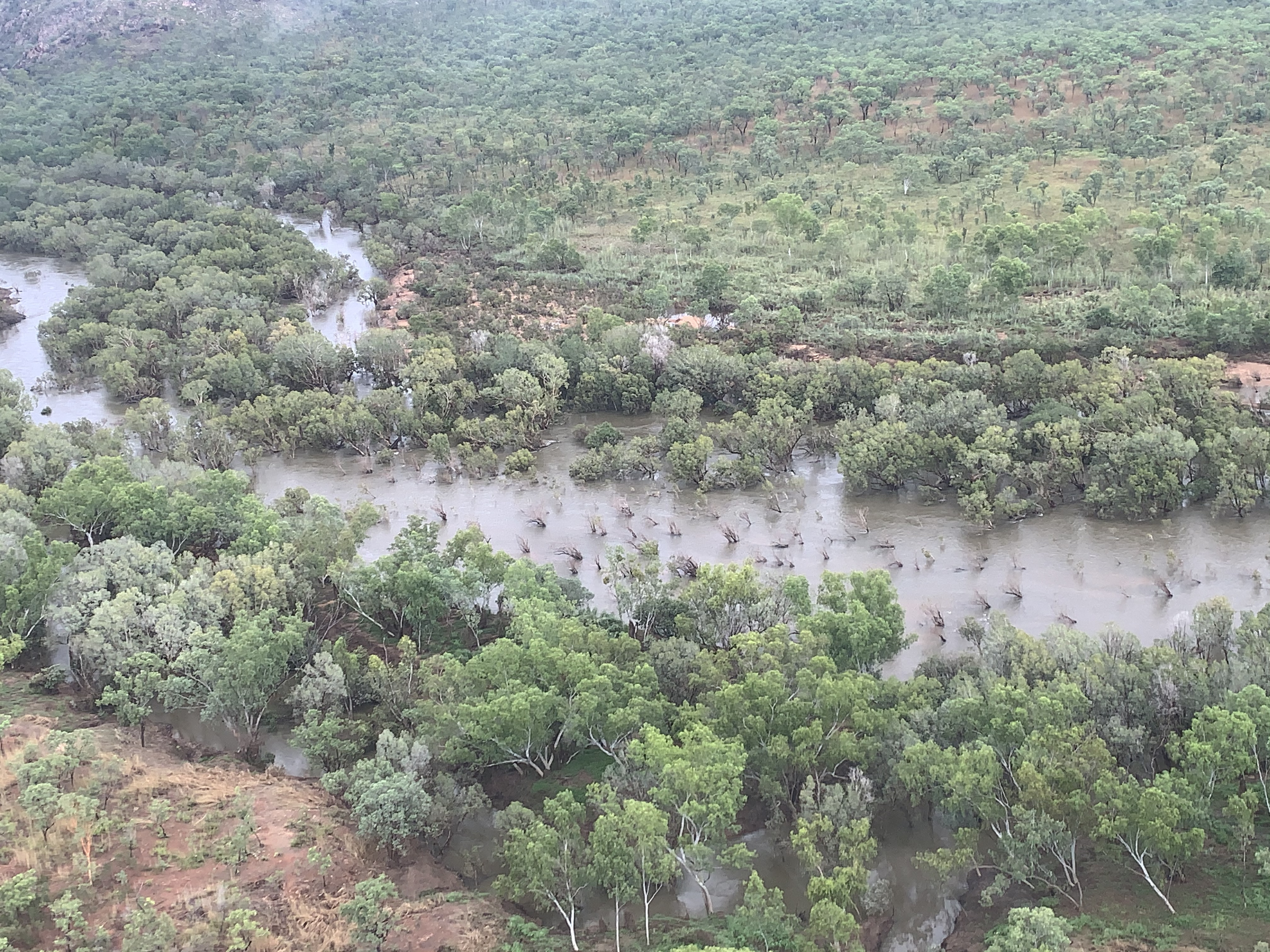
 Since this is the tail-end of the Wet, there is plenty of water
on the ground—we wonder, how much this will impact our hike.
Since this is the tail-end of the Wet, there is plenty of water
on the ground—we wonder, how much this will impact our hike.
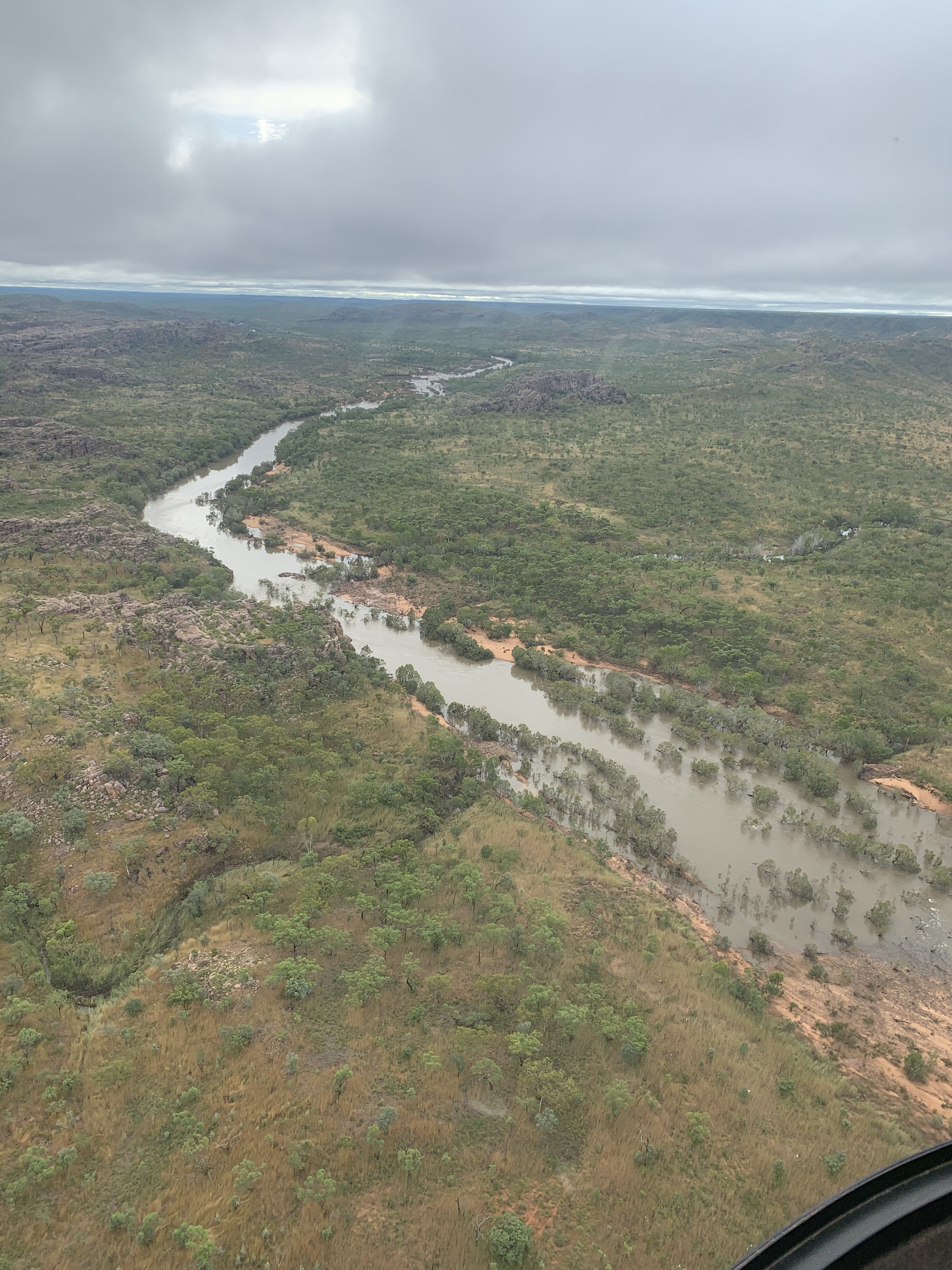
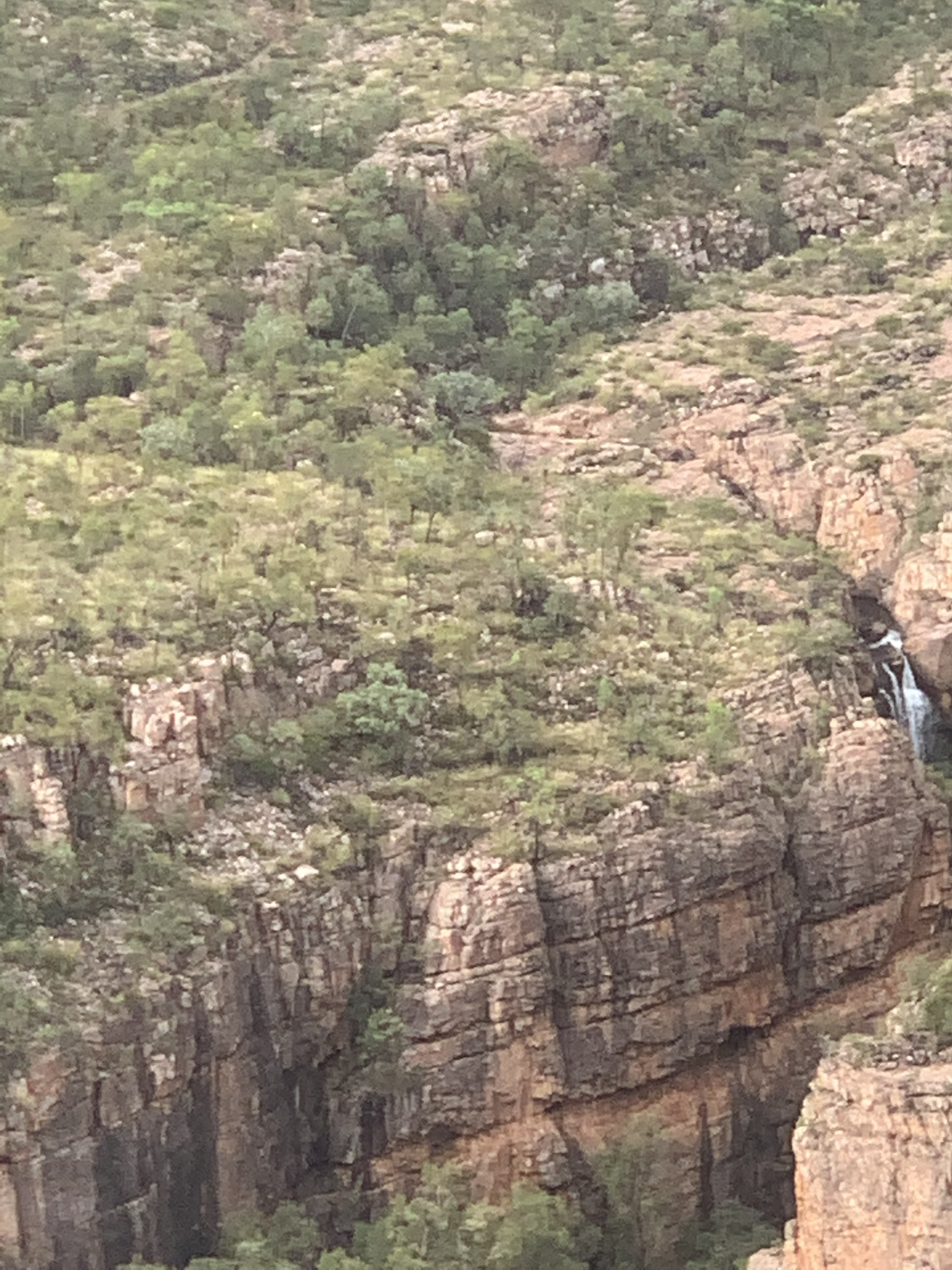
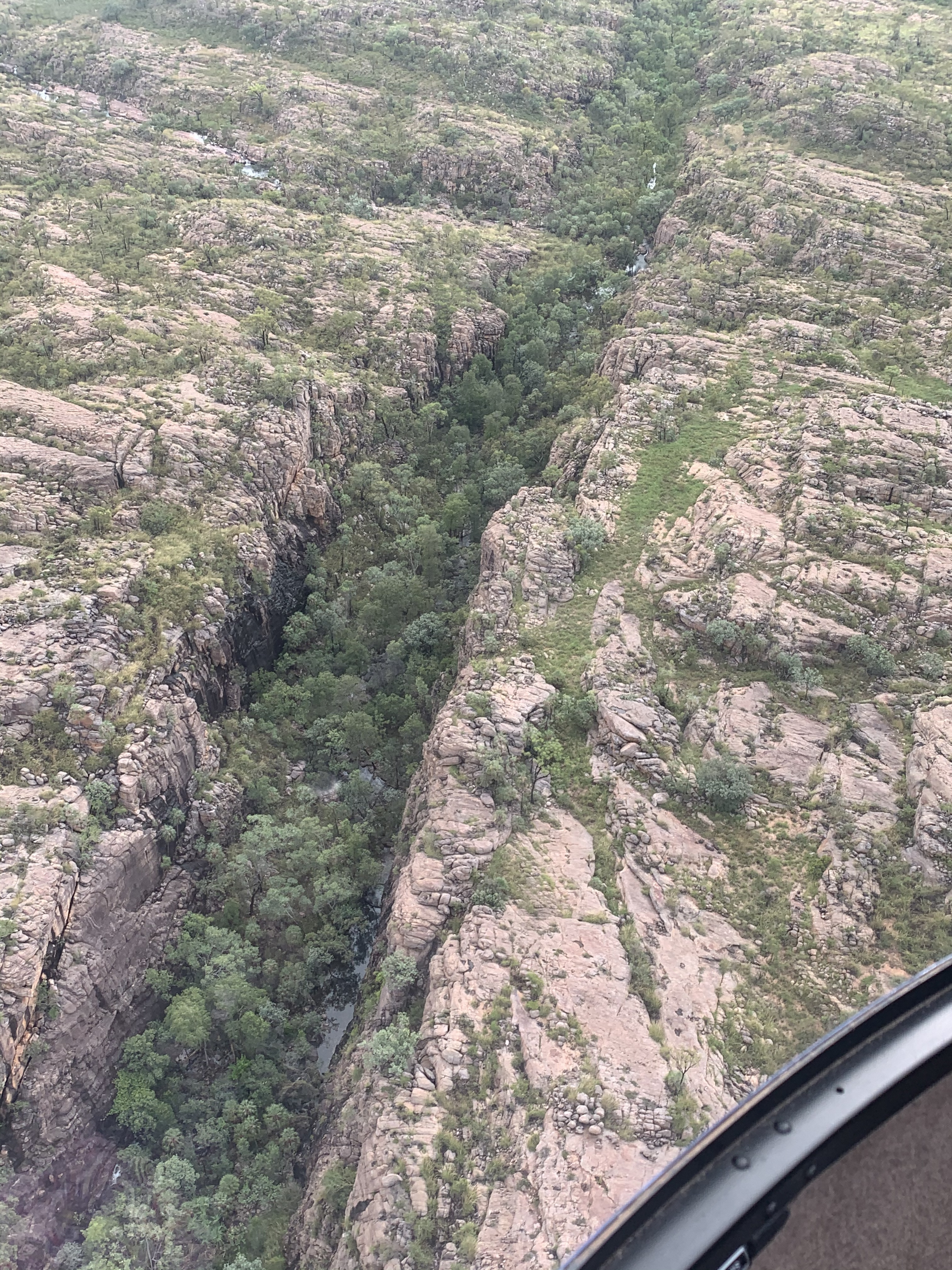
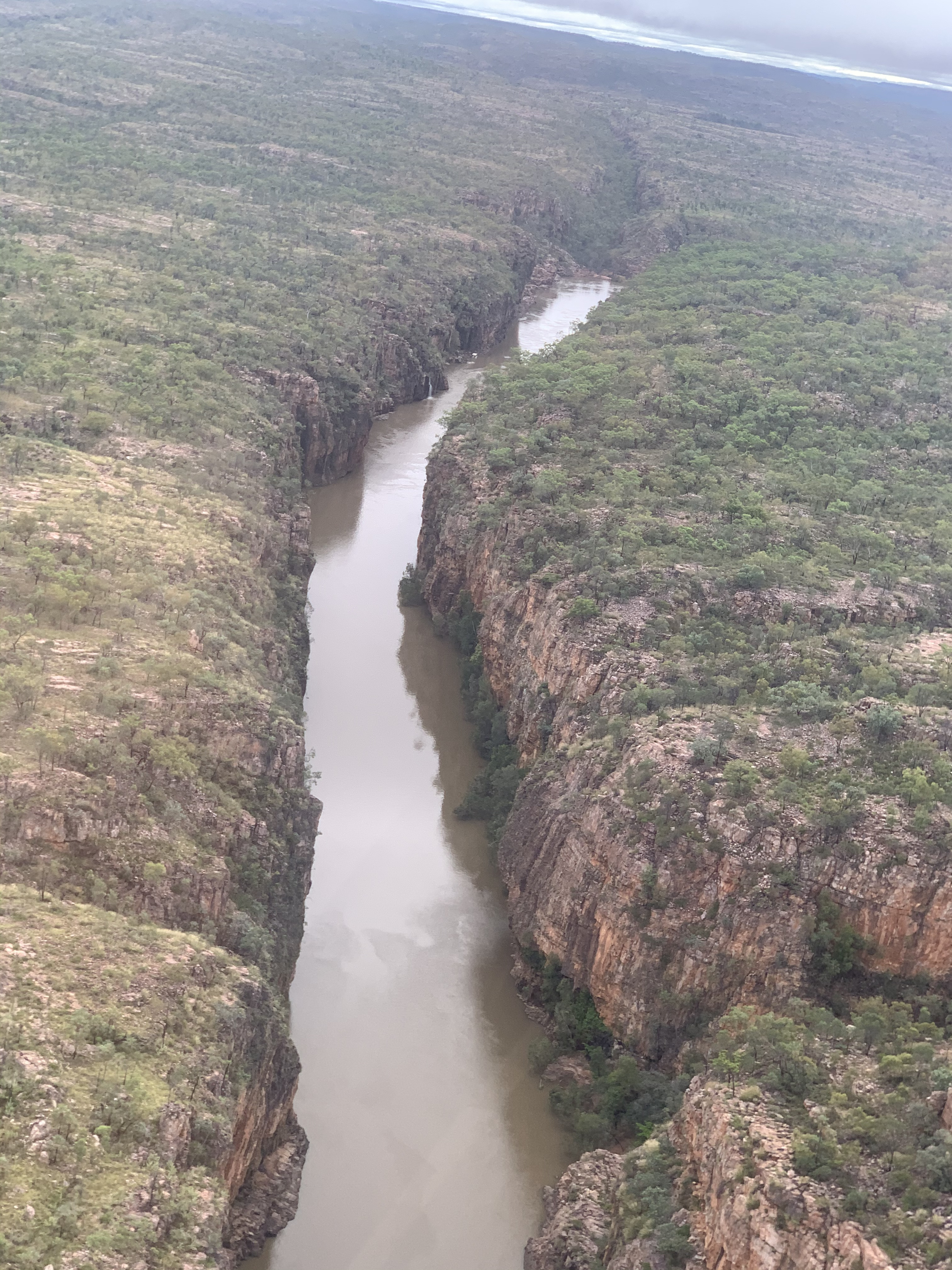
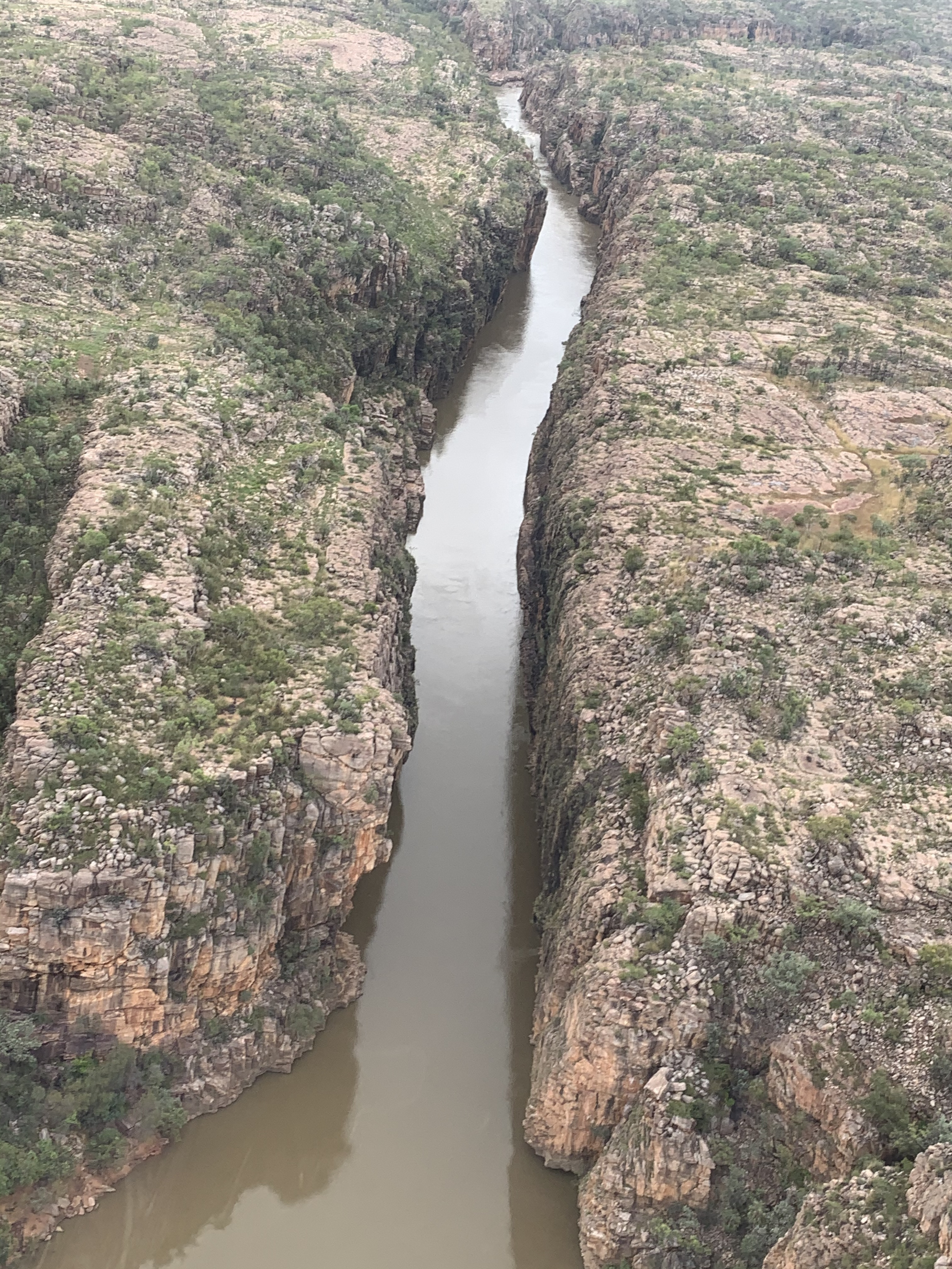
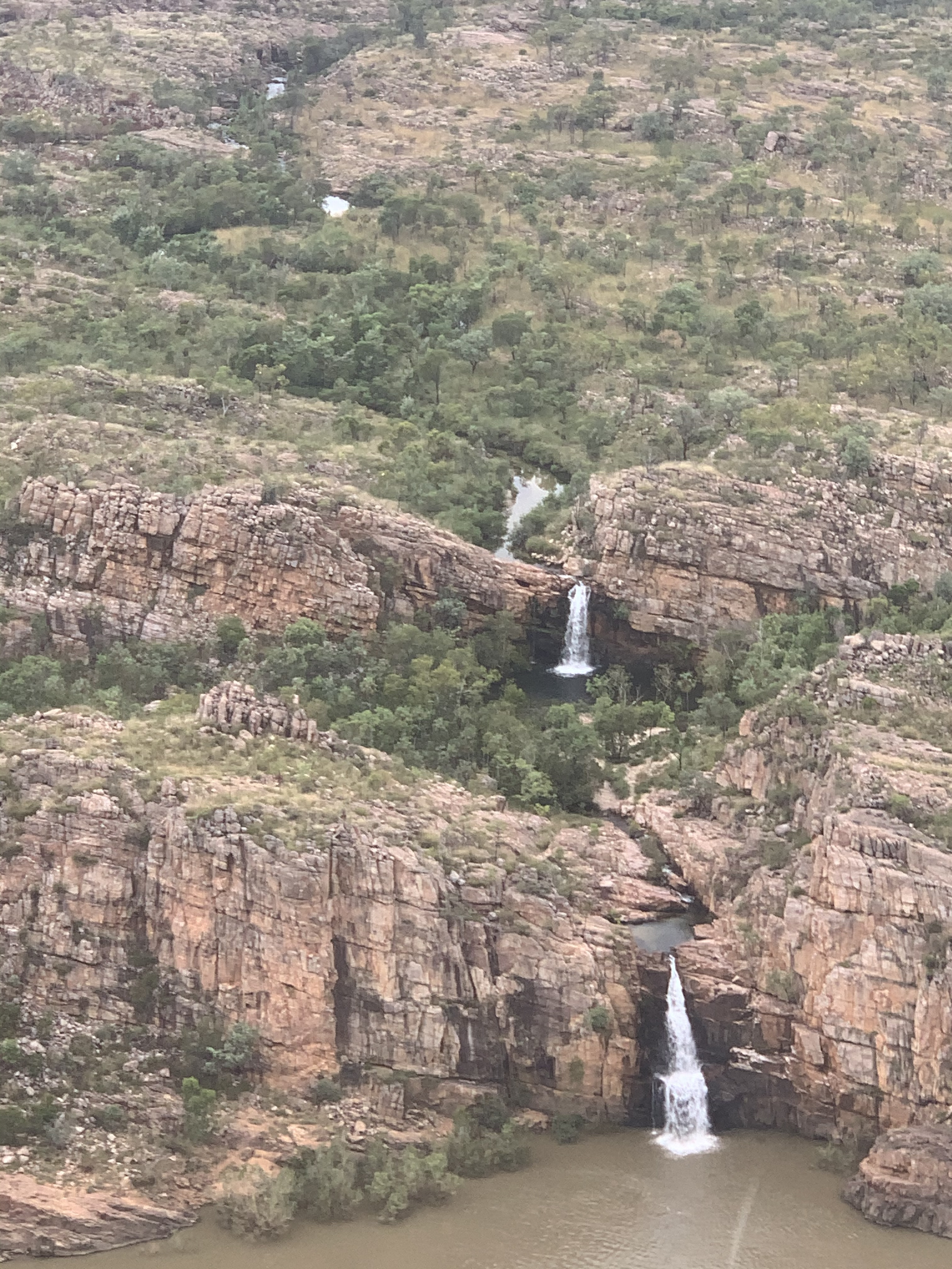
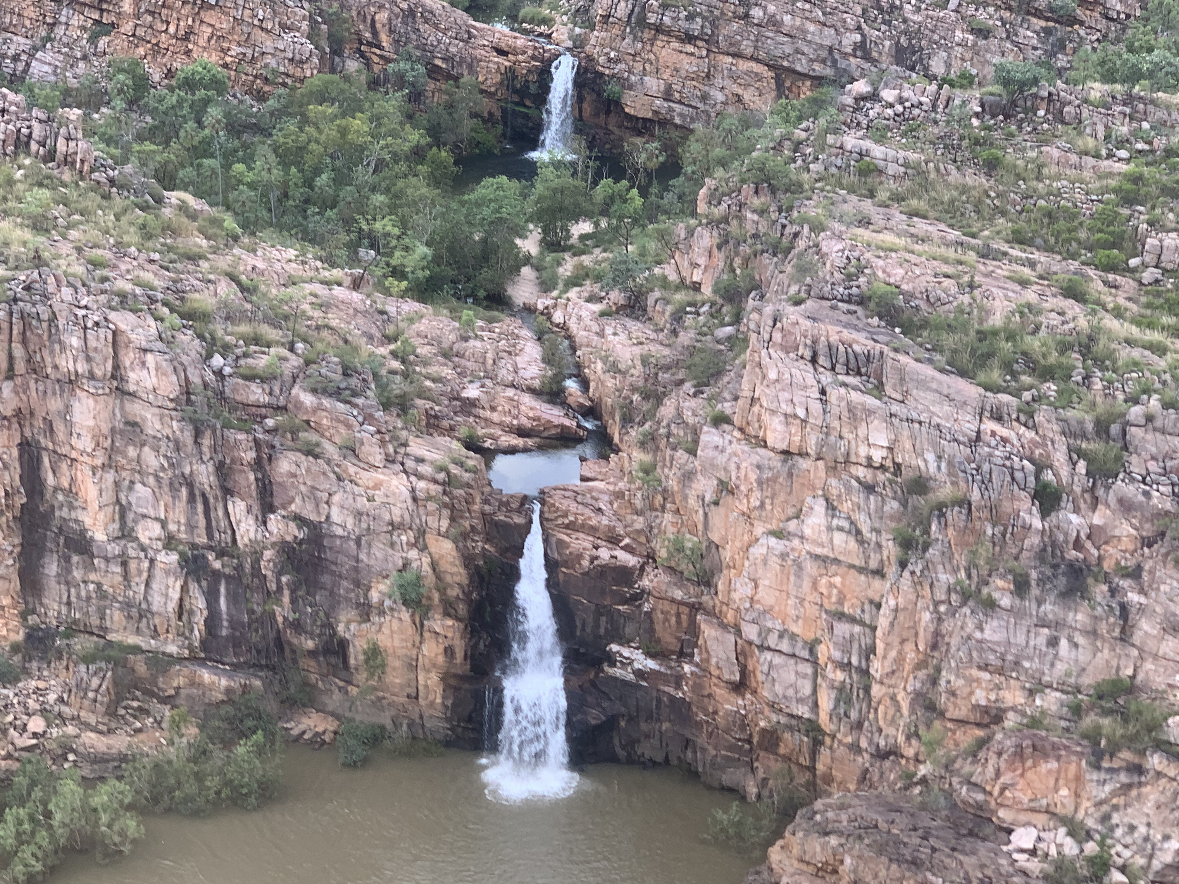
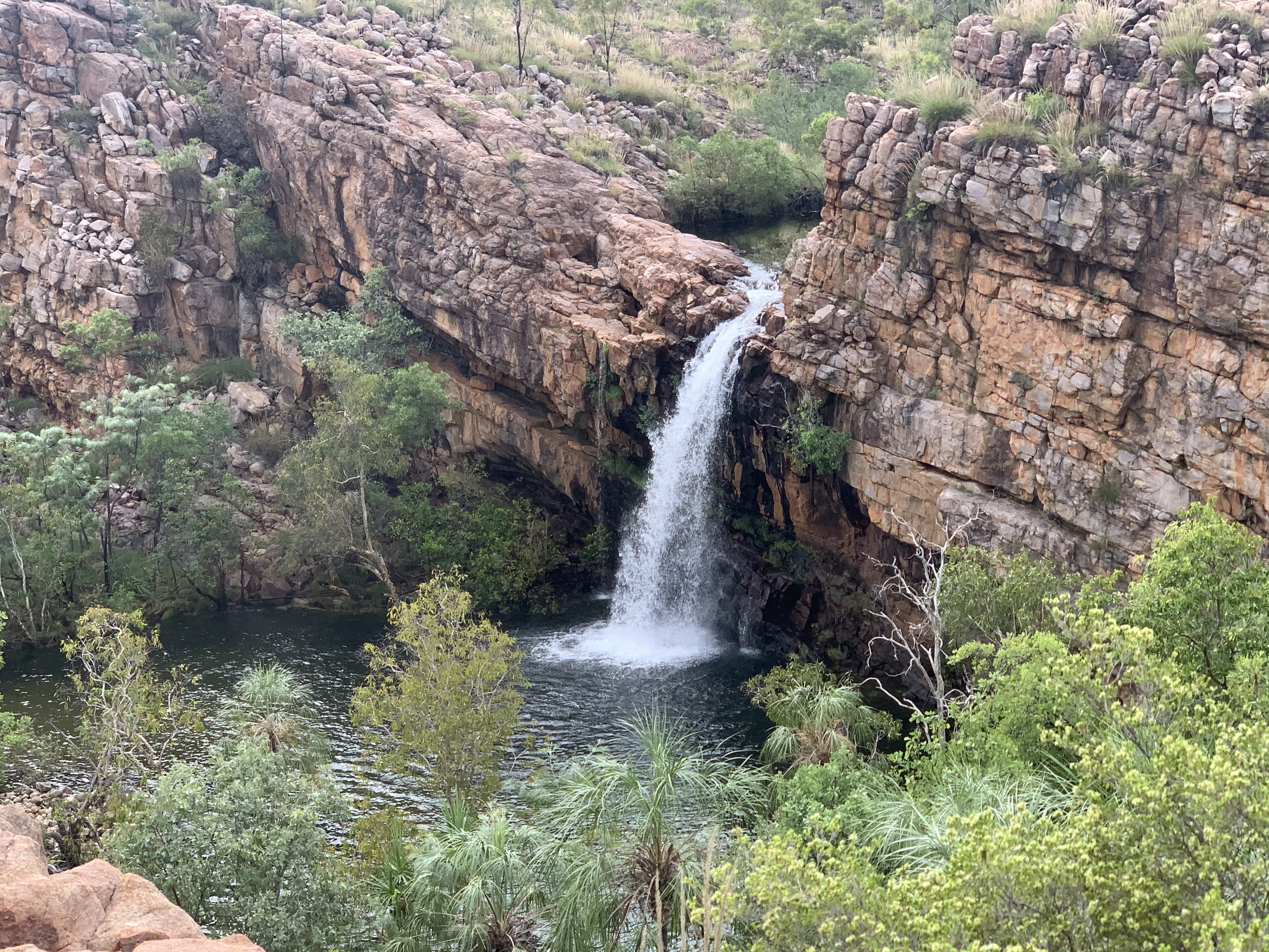
We enjoy spectacular bird's eye views of:
...angular bends...
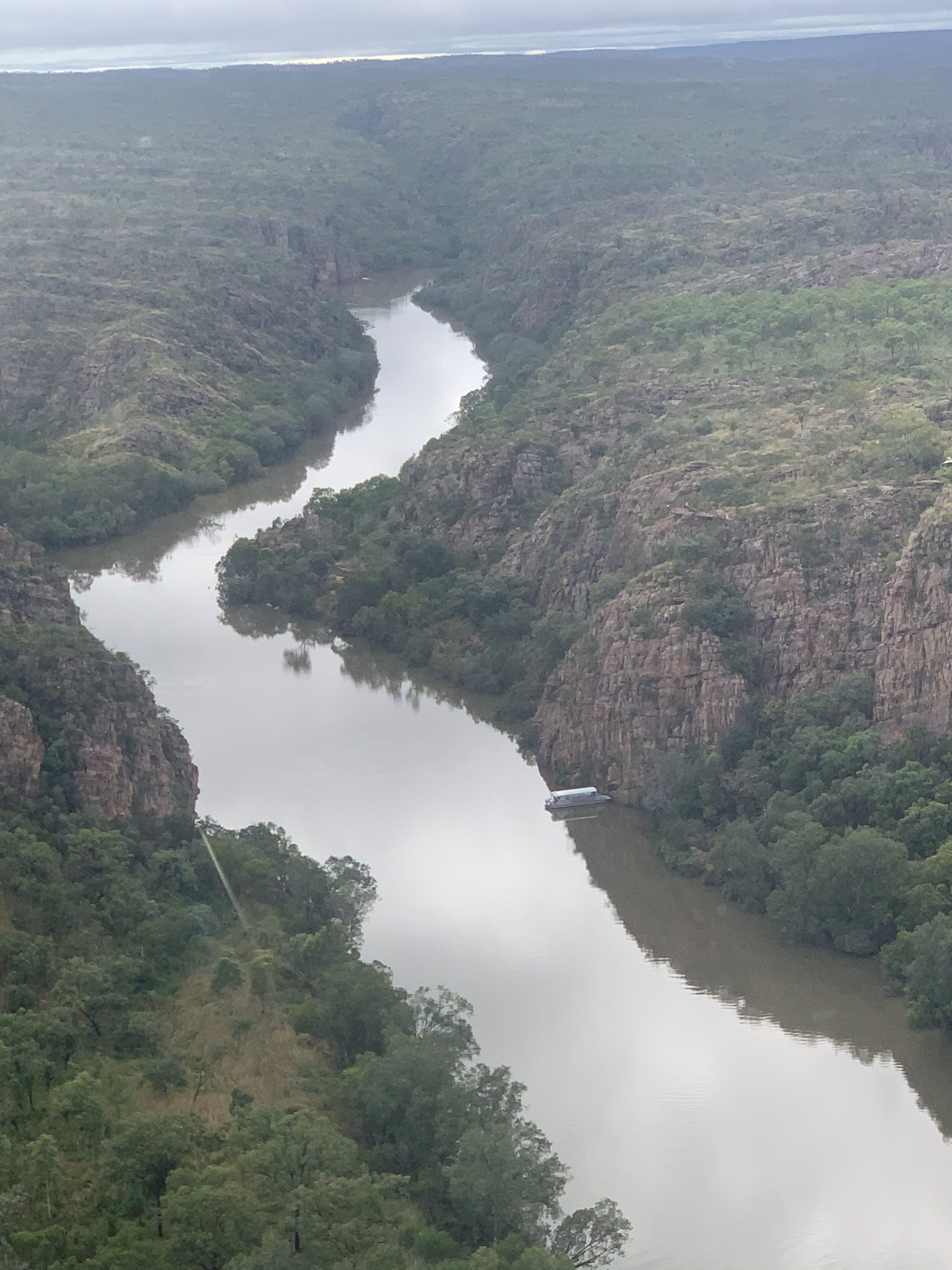
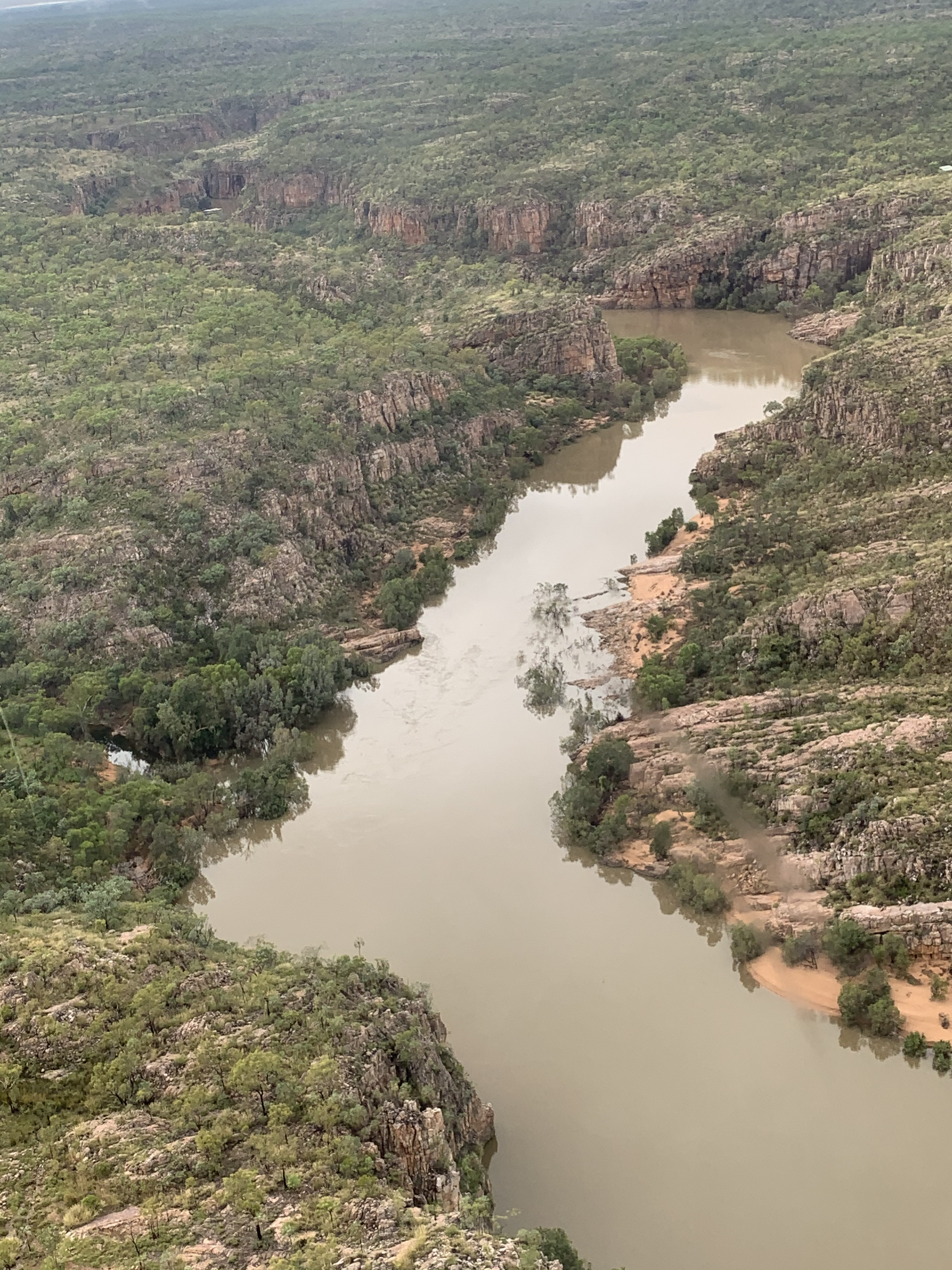
...the straight channels of gorges with vertical walls...
...and the many waterfalls that are now all running
(but will be mostly dry soon):
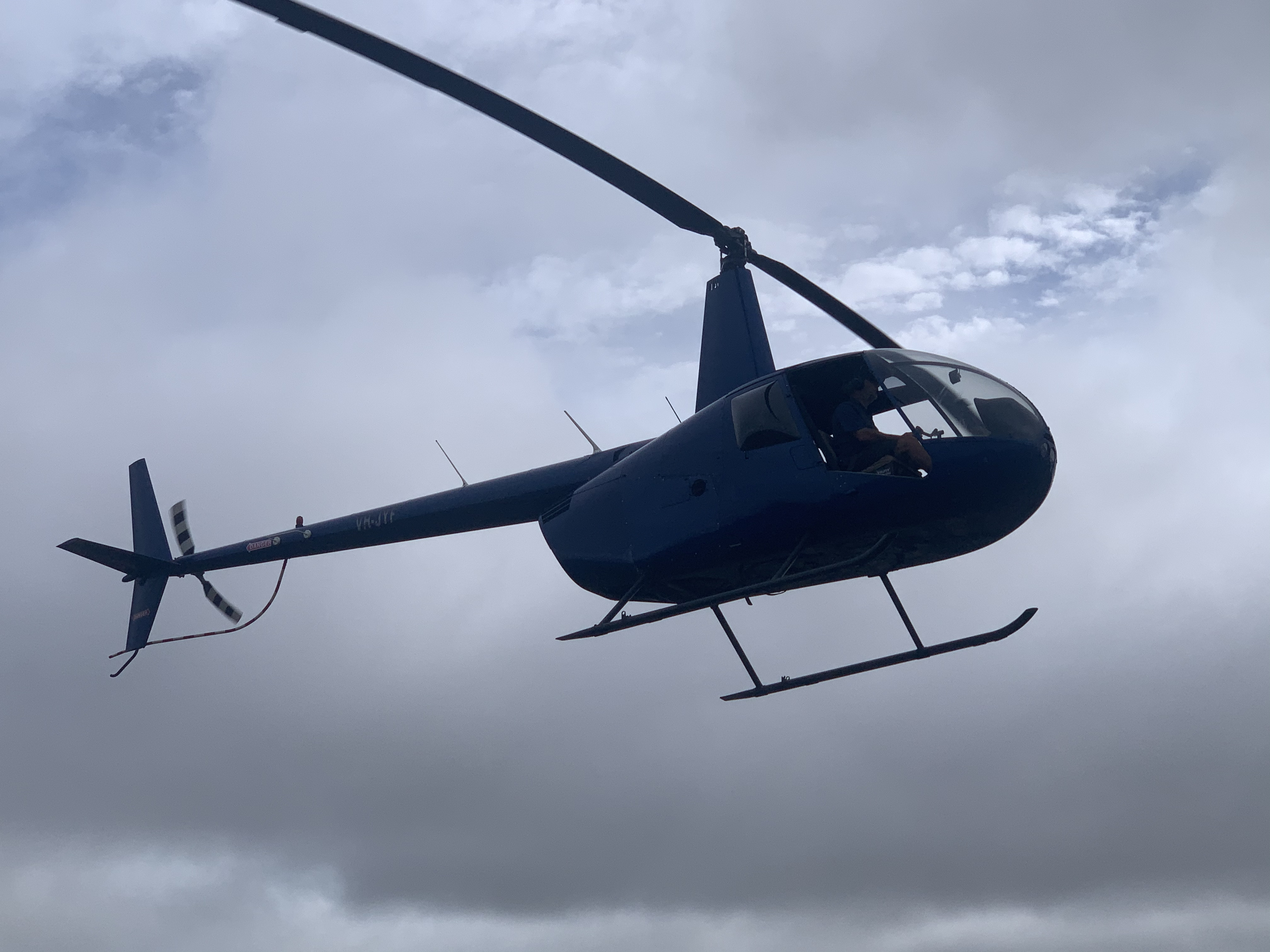
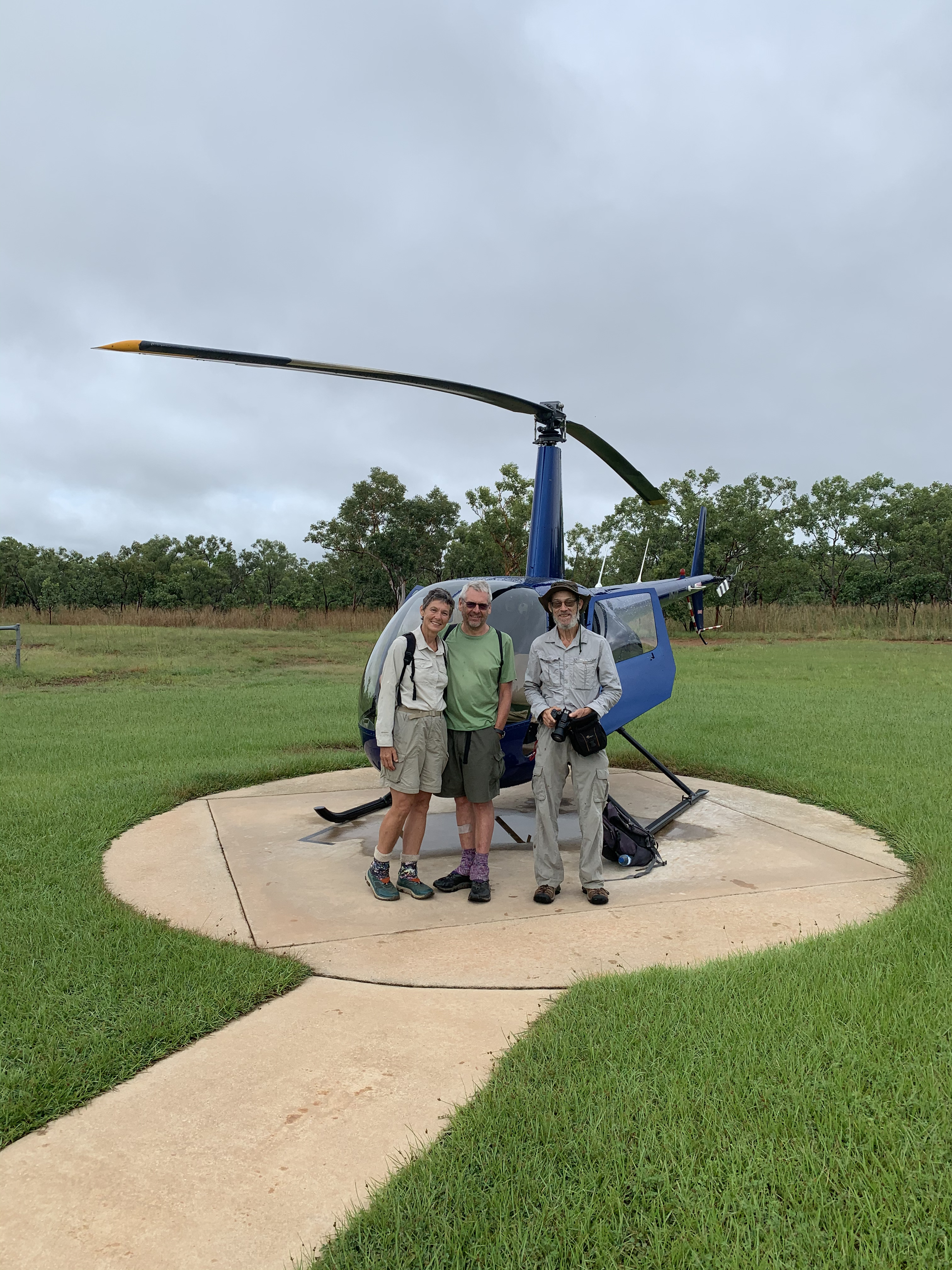
 Surveying is over: after dropping us in the wild, the chopper takes off,
leaving us to our own devices...
Surveying is over: after dropping us in the wild, the chopper takes off,
leaving us to our own devices...
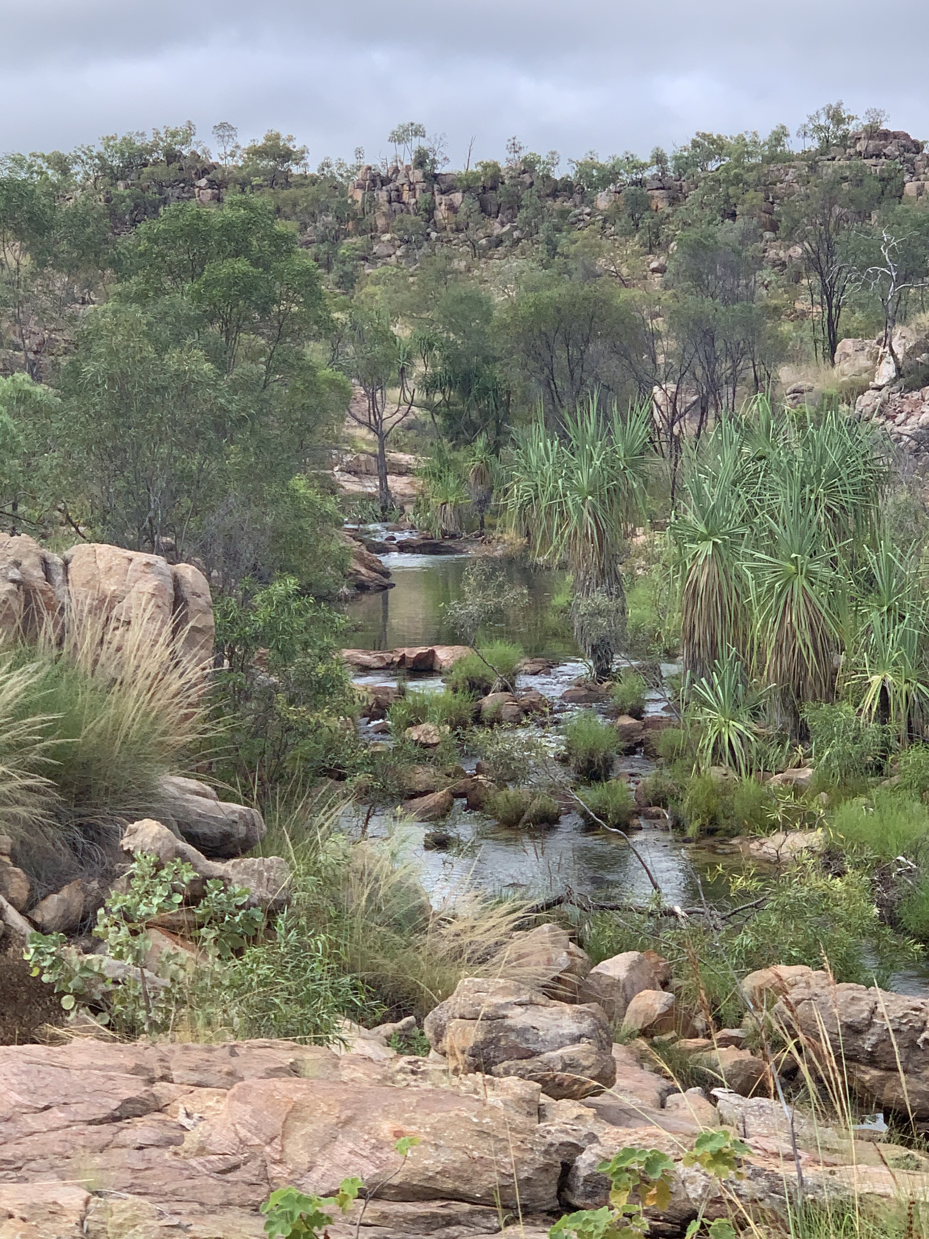
...and we have to use our own legs to progress ;-) But it's sort-of walking in paradise!
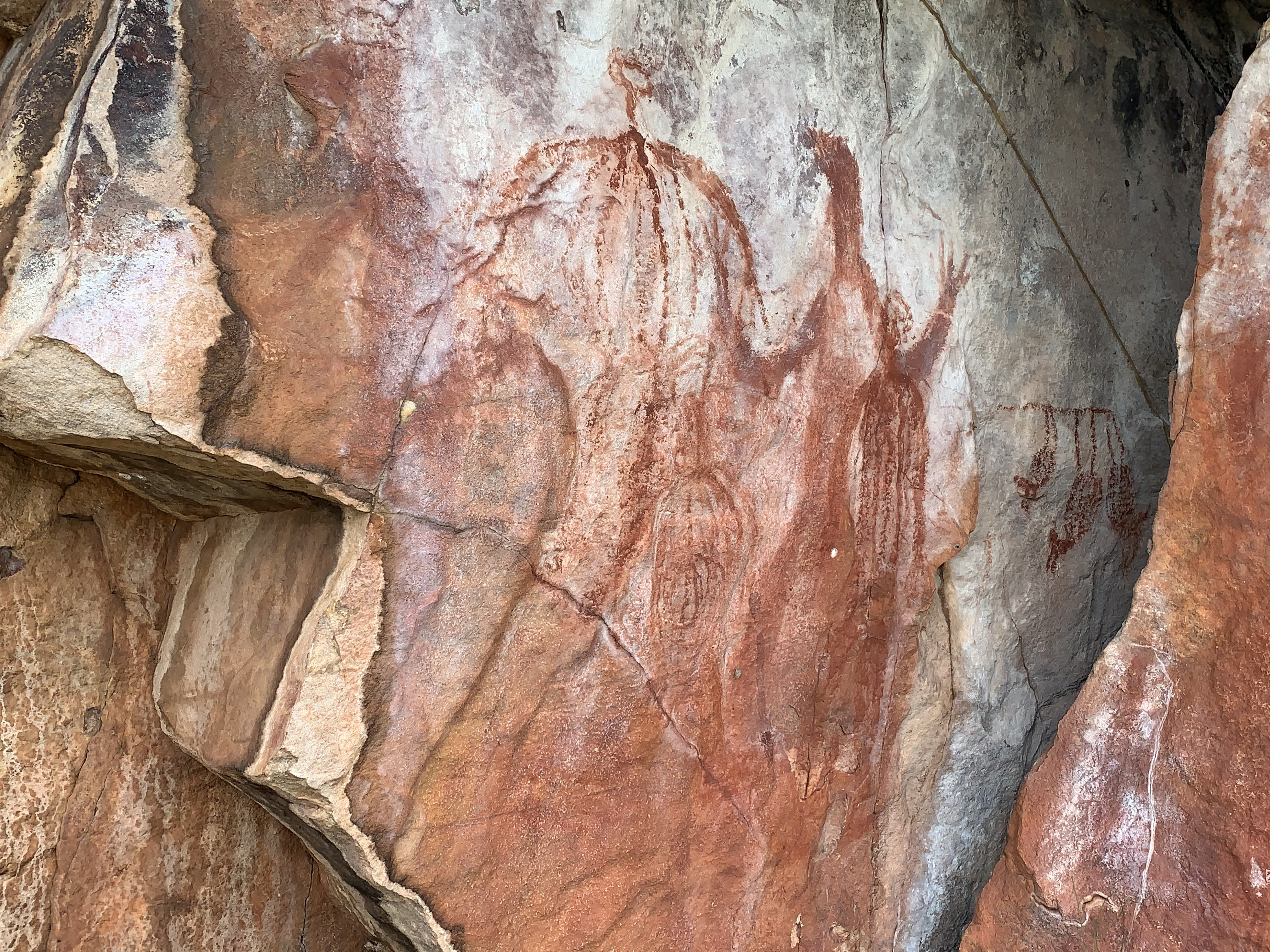
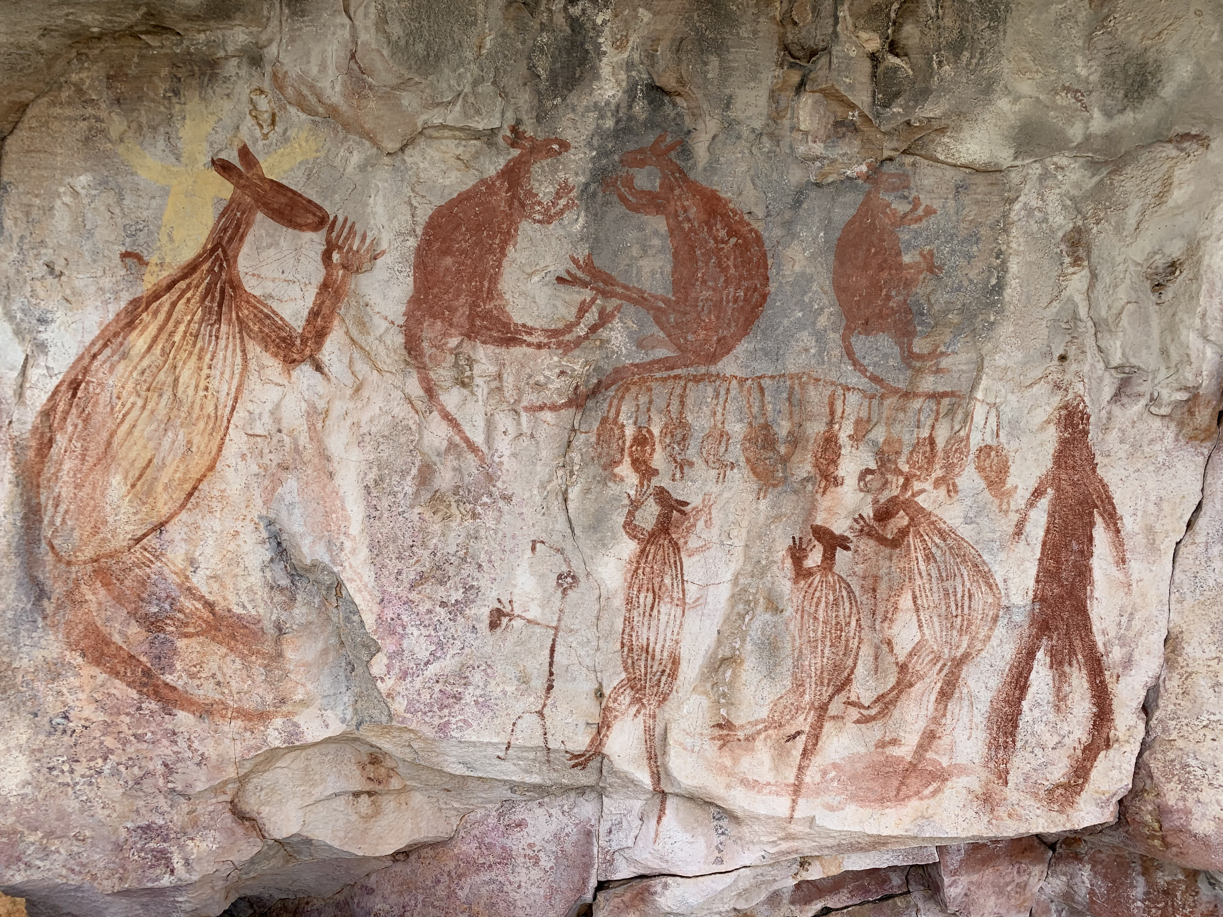 We start off with an excursion over to a rocky outcrop of the sort
that can be expected to house Aboriginal rock art, and indeed, there
are some magnificent exhibits. We spend a fair bit of time exploring
it, arguably more than we should with almost the full day still ahead
of us. But there are no regrets, especially since this is the only
significant art site of the day.
We start off with an excursion over to a rocky outcrop of the sort
that can be expected to house Aboriginal rock art, and indeed, there
are some magnificent exhibits. We spend a fair bit of time exploring
it, arguably more than we should with almost the full day still ahead
of us. But there are no regrets, especially since this is the only
significant art site of the day.
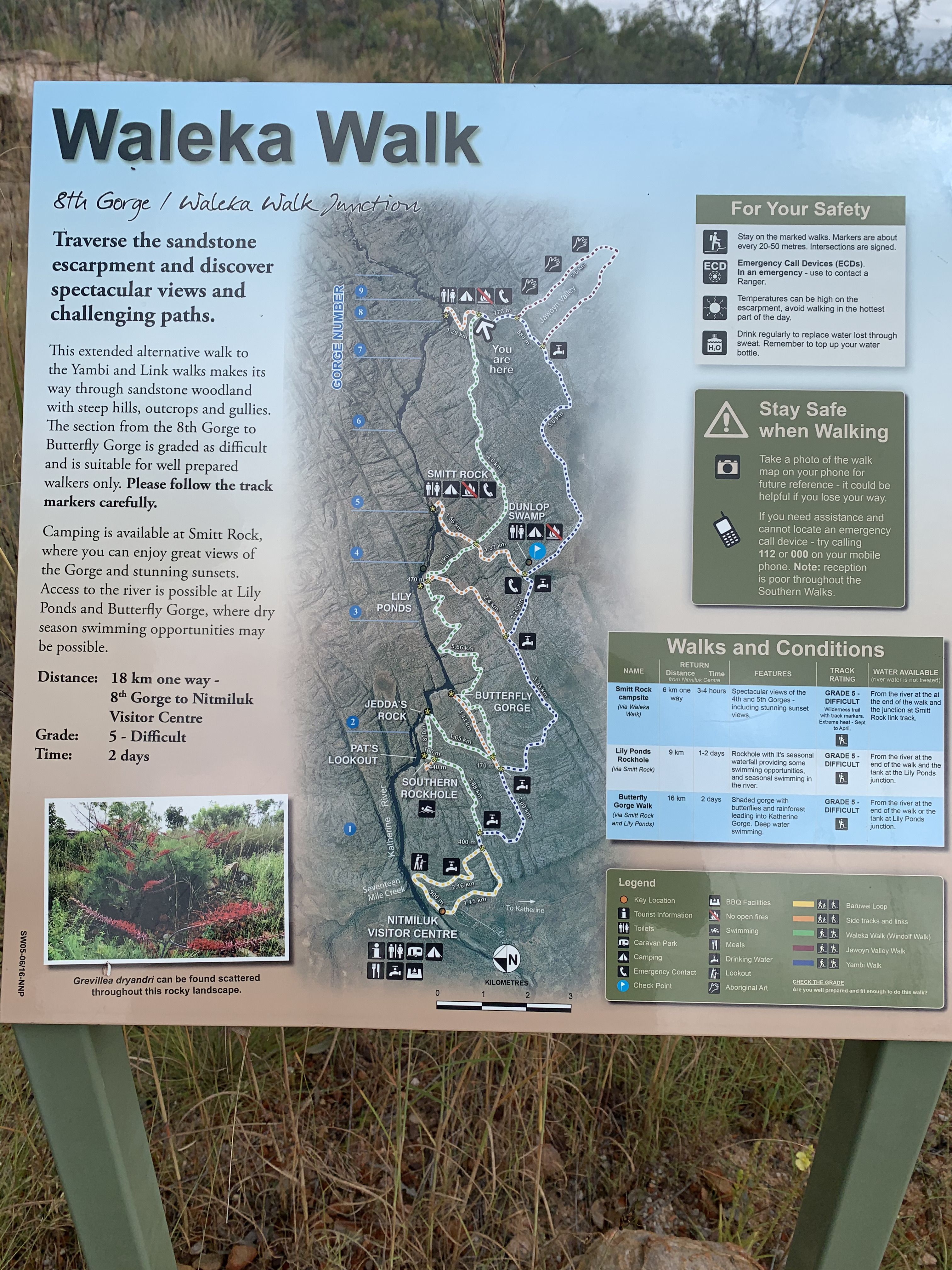 After walking a mostly well-identifiable track we come across a signage board and decide to mostly
follow the Waleka Walk, which won't stop us from exploring some
alternatives along the way.
After walking a mostly well-identifiable track we come across a signage board and decide to mostly
follow the Waleka Walk, which won't stop us from exploring some
alternatives along the way.
 We end up finding our way back to the visitor centre, notwithstanding
some interesting detours, which include a lunch-time swim in one of
the fabulous pools, and some painful cramps. By the time we reach the
visitor centre past 6pm, hilarious Gernot gives a great impersonation of a
porcupine (or should that be an echidna?)—there's no shortage of
spear grass.
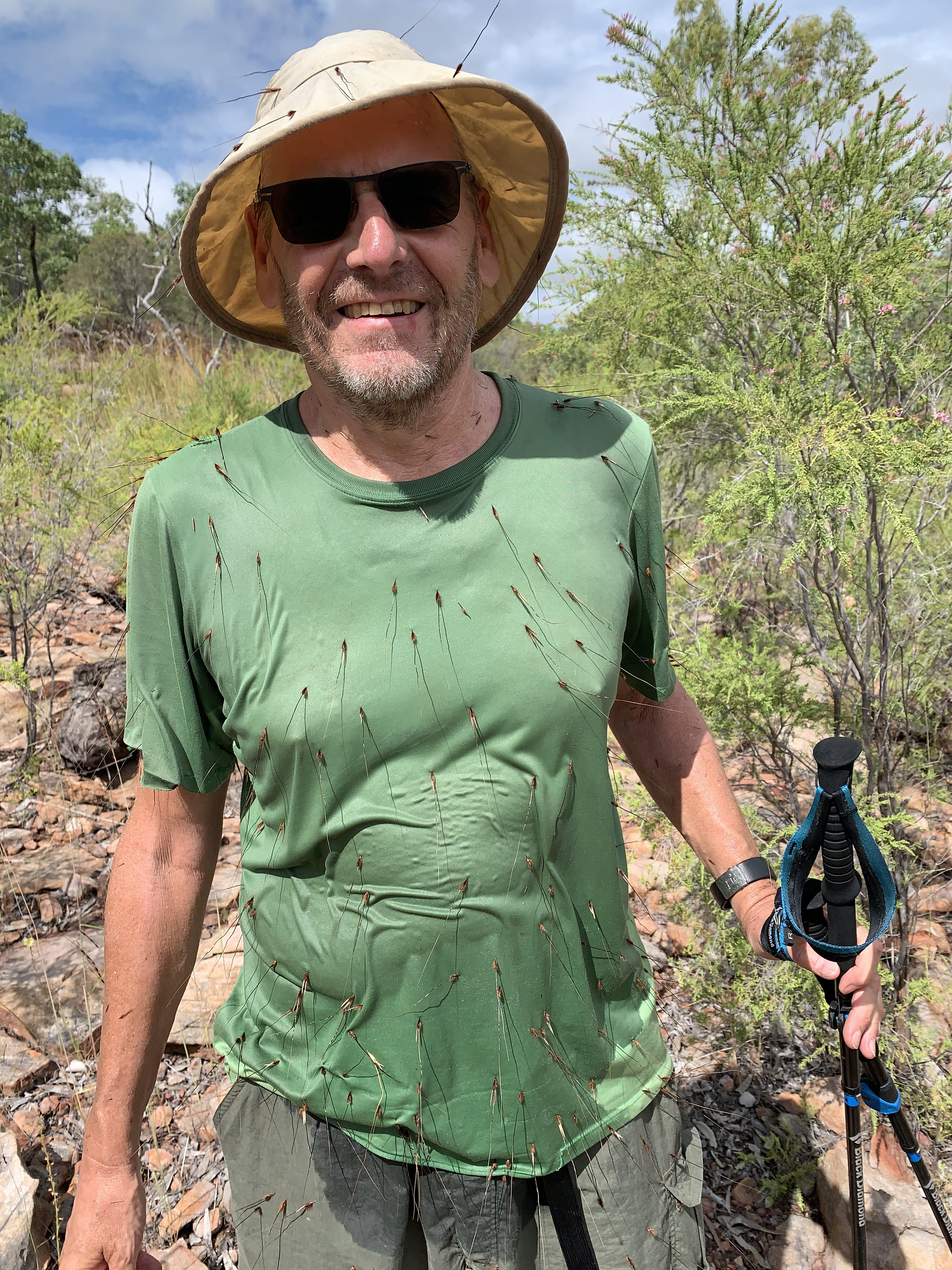
We end up finding our way back to the visitor centre, notwithstanding
some interesting detours, which include a lunch-time swim in one of
the fabulous pools, and some painful cramps. By the time we reach the
visitor centre past 6pm, hilarious Gernot gives a great impersonation of a
porcupine (or should that be an echidna?)—there's no shortage of
spear grass.
Return to main page of NT at the tail end of the Wet: Litchfield and Nitmiluk NPs main page